

los altos hills · santa clara county
Los Altos Hills Real Estate & Neighborhood Guide
Los Altos Hills covers about 9 square miles of foothills between Palo Alto, Los Altos and the Midpen open space preserves, with I-280 running through the middle. Much of the land was Rancho La Purísima Concepción, then the Taaffe Ranch, then orchards and pasture into the 1950s. Voters approved incorporation 424 to 339, and the Town became official on January 27, 1956, built around a one-acre minimum lot size that survived a 1988 ballot measure to abolish it. The Town's history describes a residential-only town with no sidewalks and no streetlights. The 2020 census counted 3,098 housing units, predominantly single-family homes on lots of an acre or more. County pockets on the southeast edge were annexed in stages through 2012.
population, 2020 census
land area
zip codes
incorporated
12175 Edgecliff Pl, Los Altos Hills, CA 94022
Single Family Home 5 Beds 5.5 Baths 3,970 SqFt
Listed by Boyenga Team of Boyenga Team / Compass27600 Altamont Rd, Los Altos Hills, CA 94022-4231
Single Family Home 6 Beds 5.5 Baths 5,800 SqFt
Listed by Eric & Janelle Boyenga of Boyenga Team / Compass25788 Bassett Ln, Los Altos Hills, CA 94022
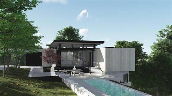
Vacant Land 5 Beds 5.5 Baths 1.49 Acres
Listed by Boyenga Team of Boyenga Team / Compass27220 Moody Rd, Los Altos Hills, CA 94022
Single Family Home 5 Beds 2 Baths 1,800 SqFt
Listed by Boyenga Team of Boyenga Team / CompassOlive Tree LN, Los Altos Hills, CA 94024
Single Family Home 7 Beds 5.5 Baths 7,500 SqFt
Listed by Maryam Dickey of Compass
21888 Blue Oaks PL, Los Altos Hills, CA 94022
Single Family Home 6 Beds 7.5 Baths 9,373 SqFt
Listed by Marc Roos of Christie's International Real Estate Sereno10285 Magdalena RD, Los Altos Hills, CA 94024
Single Family Home 7 Beds 10.5 Baths 11,093 SqFt
Listed by Gary Campi of Golden Gate Sotheby's International Realty25355 La Loma DR, Los Altos Hills, CA 94022
Single Family Home 7 Beds 7.5 Baths 8,211 SqFt
Listed by Stefan Walker of KW Bay Area Estates28008 Laura CT, Los Altos Hills, CA 94022
Single Family Home 7 Beds 7.5 Baths 7,854 SqFt
Listed by Nicholas French of Christie's International Real Estate Sereno10271 W Loyola DR, Los Altos Hills, CA 94024
Single Family Home 6 Beds 6.5 Baths 6,646 SqFt
Listed by Bogard-Tanigami Team of The Agency24970 Okeefe LN, Los Altos Hills, CA 94022
Single Family Home 5 Beds 5.5 Baths 6,732 SqFt
Listed by Gary Campi of Golden Gate Sotheby's International Realty12271 Hilltop DR, Los Altos Hills, CA 94024
Single Family Home 5 Beds 5.5 Baths 3,671 SqFt
Listed by Gary Campi of Golden Gate Sotheby's International Realty12366 Priscilla LN, Los Altos Hills, CA 94022
Single Family Home 5 Beds 5 Baths 4,790 SqFt
Listed by Judy Citron of Compass12500 Corbetta LN, Los Altos Hills, CA 94022
Single Family Home 4 Beds 3.5 Baths 4,486 SqFt
Listed by Carla Anisman of Compass26883 Dezahara WAY, Los Altos Hills, CA 94022
Single Family Home 4 Beds 4.5 Baths 4,044 SqFt
Listed by Laura McCarthy of Golden Gate Sotheby's International Realty14123 Tracy CT, Los Altos Hills, CA 94022
Single Family Home 6 Beds 6 Baths 5,956 SqFt
Listed by DeLeon Team of Deleon Realty10650 Magdalena RD, Los Altos Hills, CA 94024
Single Family Home 5 Beds 5.5 Baths 6,729 SqFt
Listed by Gretchen Swall of Compass26169 Rancho Manuella LN, Los Altos Hills, CA 94022
Single Family Home 5 Beds 3.5 Baths 4,790 SqFt
Listed by DeLeon Team of Deleon Realty26209 Dori LN, Los Altos Hills, CA 94022
Single Family Home 7 Beds 4.5 Baths 4,977 SqFt
Listed by Deniece Watkins Smith of Compass11571 Buena Vista DR, Los Altos Hills, CA 94022
Single Family Home 5 Beds 5 Baths 4,006 SqFt
Listed by Gary Campi of Golden Gate Sotheby's International Realty
CA Los Altos Hills
Los Altos Hills
Listings

neighborhoods
Los Altos Hills neighborhoods
Los Altos Hills has no official neighborhoods, so our eight guides group the Town's streets by roads and landmarks. I-280 is the main divider. North of it are the Fremont Road streets around Town Hall, the Arastradero Road and Manuella strip along the Palo Alto line, and the Burke Road and Sunset Drive streets by Los Altos. South and west of it are the Page Mill Road wedge, the Elena Road hills (our Purissima Hills guide), the Altamont, Taaffe and Moody Road hills, the Foothill College and El Monte Road streets, and the Mora Drive and Olive Tree corner. County parcel maps put the typical lot at a little over an acre. On hillside lots the Town's slope formula cuts the allowed house size. The southeast corner joined the Town in stages: Ravensbury before 2002, West Loyola (62 parcels) in 2007, and 50 parcels on La Loma, Olive Tree and Mora drives in 2012. Some homes with nearby addresses are still unincorporated county land. These include upper Moody Road around Hidden Villa and Altamont Circle (Los Altos Hills addresses), the Loyola streets beside Mora Drive (Los Altos addresses), and a few streets by Page Mill Road and I-280 (Palo Alto addresses).
Town Hall & Fremont Road
Our name for the middle of Los Altos Hills north of I-280: Town Hall, Gardner Bullis Elementary and Purissima Park, with acre-plus lots off Fremont, Concepcion, La Cresta and La Paloma roads.
Arastradero Road & Manuella
The north edge of Los Altos Hills between Arastradero and Fremont roads: Manuella and Miranda roads, Aric Lane and Weston Drive, and the lanes around Palo Alto's Esther Clark Park, split between two school districts.
Burke Road & Sunset Drive
The Los Altos side of Los Altos Hills north of I-280: Burke Road, East and West Sunset Drive and the O'Keefe Lane streets, between Robleda Road and the Los Altos line, close to downtown Los Altos.
Page Mill Road & Palo Alto Hills
The western hills of Los Altos Hills around the I-280 and Page Mill Road interchange: the college-named courts off Liddicoat Drive, Saddle Mountain, Paseo del Roble and the lanes above Matadero Creek.
Purissima Hills
One-acre-plus hill lots on the southwest side of I-280, from Elena Road up Natoma and Black Mountain roads to Taaffe and Altamont roads. Nearly all of it is in Palo Alto Unified.
Altamont, Taaffe & Moody Roads
The southwest hills along Altamont, Taaffe and Moody roads, with Westwind Barn, the 88-acre Byrne Preserve and a county pocket around Hidden Villa on upper Moody Road.
El Monte Road & Foothill College
Southeast Los Altos Hills around Foothill College and the El Monte Road interchange: Stonebrook Drive, La Loma Drive, Dawson Drive and the Summerhill streets across I-280.
Mora Drive & Olive Tree
The Town's southeast corner by Rancho San Antonio: Magdalena Road, Olive Tree Lane, Ravensbury Avenue and West Loyola Drive. Much of it was annexed from county land in stages, about 2000 to 2012.
schools
Los Altos Hills public schools
Elementary and middle
- Palo Alto Unified School District. Serves about 36% of the town's land by Census district maps: the northwest, including the Page Mill Road side, much of the Fremont Road and Purissima Road area, and the Elena Road hills. No Palo Alto Unified school operates inside the town; its former Fremont Hills Elementary site on Fremont Road closed in 1976.
- Los Altos School District. Serves about 64% of the land: the east and south, including the Burke Road side, Altamont and Moody roads, the Foothill College area and the Mora Drive corner. Gardner Bullis Elementary at 25890 Fremont Road, which reopened in 2008, is the public elementary school inside the town.
High school
- Palo Alto Unified School District. A unified district, so it also serves high school students on the Palo Alto Unified side of town.
- Mountain View-Los Altos Union High School District. Serves high school students on the Los Altos School District side of town.
property nerd note
The Palo Alto Unified / Los Altos line runs through the middle of town, sometimes between neighbors on the same road, and neighborhood names won't tell you which side you're on. Census maps are approximate. Check the exact address with each district's school locator or office, and do it before you write an offer. Boundaries and assignments change. Start with our Silicon Valley schools guide.
zip codes
Los Altos Hills ZIP codes
Covers about 83% of the town: everything except the southeast corner. Only about 42% of the 94022 area is Los Altos Hills. The rest is City of Palo Alto foothill land (about 27%), Los Altos city (about 15%) and unincorporated county land (about 15%), including Hidden Villa and upper Moody Road (Census ZCTA and place maps).
Covers about 17% of the town: the Mora Drive, Olive Tree, Ravensbury and West Loyola streets, the Dawson Drive area and most of the Summerhill Avenue pocket. Only about 18% of 94024 is Los Altos Hills; most of it is Los Altos city, the unincorporated Loyola area and county open space such as Rancho San Antonio.
RECENTLY SOLD LISTINGS

$4,000,000
Single Family Home
22580 Ravensbury AVE, Los Altos Hills, CA 94024
The best views in Los Altos Hills! This impressive hilltop estate is a true retreat, offering unparalleled vistas that s...
Listed by Boyenga Team of Compass

$4,000,000
Single Family Home
22580 Ravensbury AVE, Los Altos Hills, CA 94024
The best views in Los Altos Hills! This impressive hilltop estate is a true retreat, offering unparalleled vistas that s...
Listed by Boyenga Team of Compass


$5,750,000
Single Family Home
12425 Hilltop DR, Los Altos Hills, CA 94024
Tastefully remodeled contemporary home in a prime Los Altos Hills/Summerhill location. Spanning 3,362 square feet of liv...
Listed by Boyenga Team of Compass
MARKET TRENDS

listing detail
getting around
Getting around Los Altos Hills
I-280
The freeway crosses the town diagonally, with interchanges at Page Mill Road on the west, El Monte Road / Moody Road at Foothill College, and Magdalena Avenue on the southeast edge. There is no interchange in between, so the Elena Road hills use Page Mill Road or El Monte Road.
Caltrain
No station in town. From Town Hall, San Antonio station in Mountain View is about 2.4 miles straight-line and California Avenue in Palo Alto about 3.1 miles. Driving distances are longer.
Buses
VTA routes 40 and 52 serve Foothill College on El Monte Road.
Pathways
Roads have no sidewalks. The Town's pathway plan aims to put a roadside or off-road path next to or across the street from every home, using easements gathered as lots are subdivided or developed. Many paths connect to Midpen and Palo Alto preserves.
living here
Living in Los Altos Hills
Town Hall
The Town's offices are at 26379 Fremont Road, on the north side of town. The Town's history notes that police and fire protection come from outside agencies rather than Town departments.
Westwind Barn and Byrne Preserve
On upper Altamont Road, the Town-owned Westwind Community Barn (a 24,000-square-foot barn on about 15 acres) runs boarding, riding and 4-H therapeutic riding programs. Next door, the 88-acre Byrne Preserve is the Town's largest open space, used for hiking, riding and outdoor education.
Purissima Park
At 27500 Purissima Road: the Town's Little League fields and riding arena (about 10 acres), a dog park and the Town Riding Ring. The renovated park reopened in 2009.
Rancho San Antonio and Midpen preserves
Rancho San Antonio (2,180 acres plus a 293-acre county park, with more than 25 miles of trail and Deer Hollow Farm) borders the town's south edge, with a Rhus Ridge parking area at its north end. The Town's General Plan also lists nearby Midpen preserves at Foothills, Monte Bello and Los Trancos.
Hidden Villa
A 1,600-acre nonprofit preserve and educational farm on upper Moody Road, with trails and a youth hostel. It sits in the unincorporated county pocket.
Foothill College
The 122-acre campus opened in 1961, designed by Ernest J. Kump with Masten & Hurd. Its observatory holds free public viewing on clear Friday nights and solar viewing on clear Saturday mornings.
your los altos hills team
Buy or sell in Los Altos Hills with the Boyenga Team
Eric and Janelle Boyenga and the Property Nerds® at Compass have sold more than 2,520 Silicon Valley homes, $2.6+ billion in all, since 1996. We know Los Altos Hills block by block, from pricing and prep to the off-market homes most buyers never see.
Search Los Altos Hills homes Get my home value (408) 373-1660 (650) 383-8606
how we help
Property Nerds® in Los Altos Hills
Pricing from the data
We compare recent sales street by street, adjusting for lot, condition, schools and style, so you buy or list at a price the market will support.
Prep that pays
Selling? We focus prep money where Los Altos Hills buyers notice it. Compass Concierge can start eligible work with nothing due upfront.
See homes first
Buying? Compass Private Exclusives and our network show you homes before they reach the public sites.
faq
Los Altos Hills real estate FAQ
Does Los Altos Hills have neighborhoods?
Not officially. The Town has no neighborhood districts. Our eight guides group streets by the roads and landmarks people use, such as Fremont Road and Town Hall, Page Mill Road, Elena Road, Altamont and Moody roads, Foothill College and Mora Drive.
What is the minimum lot size, and how big can a house be?
The Town keeps a one-acre minimum for new lots. House size is set by a lot unit factor based on net acreage and average slope. The Town's October 2025 worksheet allows up to 6,000 sq ft of floor area per unit on lots of 10% slope or less and 5,000 sq ft per unit at 30% slope or more, with separate caps on total development area. Many smaller projects go through the Town's staff-level 'Fast Track' review, which began in 1999.
Which school district serves Los Altos Hills?
Two systems split the town. Palo Alto Unified serves the northwest, about 36% of the land. Los Altos School District and Mountain View-Los Altos Union High School District serve the rest. Check the exact address with the districts.
Is Los Altos Hills in a fire hazard zone?
Parts of it are. On June 24, 2025 the Council adopted the state fire marshal's minimum hazard map after dropping a broader version. On that 2025 state data, our checks found the canyon streets south of Moody Road and much of the Mora Drive and Olive Tree corner in Very High zones, while the Elena Road and Altamont Road hills map mostly as Moderate. Check each parcel; the zones affect building standards, defensible space and disclosures.
Are all homes with a Los Altos Hills address in the town?
No. Hidden Villa, Altamont Circle, Canyon Road and some upper Moody Road parcels use Los Altos Hills 94022 addresses but are unincorporated county land, so the county handles planning and permits there. The Loyola streets beside Mora Drive and a few streets near Page Mill Road and I-280 are also county land, with Los Altos or Palo Alto addresses.
More Property Nerd guides: Palo Alto Los Altos Redwood City Menlo Park San Carlos Belmont San Mateo Burlingame San Francisco Atherton Mountain View Cupertino Sunnyvale Los Gatos Monte Sereno Saratoga Campbell Santa Clara Woodside Portola Valley San José neighborhoods Silicon Valley schools

Coming Soon
Commute Score
Coming Soon
Coming Soon
demographics
Population:
Density:
Households:
Gender
Coming Soon
Coming Soon
Coming Soon
Coming Soon
more los altos hills neighborhood guides
Neighborhood guides in Los Altos Hills
See every guide in the Nerd Portal.

Eric & Janelle Boyenga
homes@boyenga.com