

san mateo · san mateo county
San Mateo Real Estate & Neighborhood Guide
San Mateo runs from the bay, where Coyote Point, the Marina Lagoon and levee-protected neighborhoods sit east of US 101, across a flat middle along El Camino Real and the Caltrain line, up to the western hills at Sugarloaf Mountain. The city's history page says trains first served San Mateo on October 17, 1863 and that voters chose incorporation 150 to 25 on September 3, 1894. Estates were split into neighborhoods from the late 1800s through the 1930s, and the postwar years brought Hillsdale Shopping Center and large tracts, per the city's general plan EIR. County parcel records count about 17,900 single-family lots and about 9,800 condominium and townhome units in the city; the 2020 census counted 42,229 housing units.
population, 2020 census
land area
zip codes
incorporated
637 Vanessa Dr, San Mateo, CA 94402-2616
Single Family Home 4 Beds 2 Baths 1,400 SqFt
Listed by Eric & Janelle Boyenga of Boyenga Team / Compass1586 Lexington AVE, San Mateo, CA 94402
Single Family Home 3 Beds 2 Baths 2,190 SqFt
Listed by Boyenga Team of Compass
1619 Echo Avenue, San Mateo, CA 94401
Single Family Home 3 Beds 2 Baths 1,584 SqFt
Listed by Boyenga Team of Boyenga Team / Compass1711 Parkwood DR, San Mateo, CA 94403
Single Family Home 4 Beds 3 Baths 2,610 SqFt
Listed by Neil Canlas of The Canlas Brothers
967 Shoal DR, San Mateo, CA 94404
Single Family Home 3 Beds 3 Baths 2,100 SqFt
Listed by Fion Yau Yau of KW Advisors1103 Birch AVE, San Mateo, CA 94402
Single Family Home 3 Beds 3 Baths 1,250 SqFt
Listed by Monica M Sagullo of Hatch Realty Group, Inc.58 Burbank AVE, San Mateo, CA 94403
Single Family Home 2 Beds 1 Bath 1,180 SqFt
Listed by Heather R Stoltz of Berkshire Hathaway-Franciscan400 Mariners Island Blvd 115, San Mateo, CA 94404
Condo 2 Beds 2 Baths 1,353 SqFt
Listed by Asif Kazi of EXP Realty of California, Inc
3415 La Selva, San Mateo, CA 94403
Single Family Home 2 Beds 1.5 Baths 1,190 SqFt
Listed by Travis Azevedo of A2Z Homes, Inc.30 Mounds Rd 201, San Mateo, CA 94402
Condo 2 Beds 2 Baths 1,352 SqFt
Listed by Gabriela Maciel of JPAR Iron Horse Real Estate1687 Bayridge WAY #105, San Mateo, CA 94402
Condo 2 Beds 2 Baths 1,064 SqFt
Listed by Brendan C Landeck of Laurel Realty & Investment401 S Norfolk St 301, San Mateo, CA 94401
Condo 1 Bed 1 Bath 729 SqFt
Listed by Robert Sun of Redfin3090 Los Prados 24, San Mateo, CA 94403
Condo 2 Beds 2 Baths 900 SqFt
Listed by Steve Hill of Balboa Real Estate324 Catalpa St 120, San Mateo, CA 94401
Condo 1 Bed 1 Bath 640 SqFt
Listed by Helen Duncan of Better Homes and Gardens RP709 Hurlingham AVE, San Mateo, CA 94402
Single Family Home 5 Beds 4.5 Baths 4,275 SqFt
Listed by Michele Oravec of Compass128 Clark DR, San Mateo, CA 94402
Single Family Home 4 Beds 3.5 Baths 3,802 SqFt
Listed by Daniel Buckley Chavez of Coldwell Banker Realty118 Rosewood Lane, San Mateo, CA 94402
Single Family Home 5 Beds 5.5 Baths 3,600 SqFt
Listed by The Laugesen Team of KW Advisors9 Bel Aire, San Mateo, CA 94402
Single Family Home 4 Beds 4.5 Baths 3,908 SqFt
Listed by The Laugesen Team of KW Advisors18 Bel Aire LN, San Mateo, CA 94402
Single Family Home 5 Beds 4.5 Baths 3,977 SqFt
Listed by The Laugesen Team of KW Advisors342 Parrott DR, San Mateo, CA 94402
Single Family Home 4 Beds 3.5 Baths 3,380 SqFt
Listed by Jenn Gilson of Golden Gate Sotheby's International Realty
CA San Mateo
San Mateo
Listings
- 1/16 16
 3 Beds 2 Baths 2,190 SqFt$4,498,000Active
 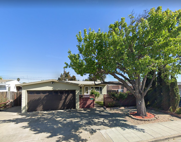 3 Beds 2 Baths 1,584 SqFt$1,350,000Active
- 1/59 59
 4 Beds 3 Baths 2,610 SqFt$2,699,888Active
1711 Parkwood DR, San Mateo, CA 94403
Listed by Neil Canlas of The Canlas Brothers
Single Family Home
neighborhoods
San Mateo neighborhoods
Our 14 San Mateo guides follow the city's neighborhood-association and neighborhood map lines. Downtown & Central and North Central & San Mateo Heights hold the older grids around the San Mateo station, where the general plan EIR dates the Central subdivisions to the late 1800s and San Mateo Heights to the early 1900s. San Mateo Park (early 1900s), Hayward Park & Glazenwood (built up after 1906, with Glazenwood's 1920s Spanish Colonial Revival homes) and Baywood & Aragon (1930s) line El Camino Real. South of SR 92 the flats fill with Sunnybrae & 19th Avenue Park, Fiesta Gardens & Bay Meadows (Bay Meadows is the former racetrack site), San Mateo Village & Lauriedale and Beresford & Hillsdale. Laurelwood & Sugarloaf, Baywood Park & College Heights and The Highlands climb the western hills, and Shoreview & Parkside and Mariner's Island & Lakeshore sit east of US 101 around the Marina Lagoon. Watch the edges: the Highlands and most of Baywood Park are unincorporated county land with San Mateo addresses, and Mariner's Island uses Foster City's ZIP. Lot sizes vary: county parcel maps put the median single-family lot near 5,100 to 5,300 square feet in Shoreview and Parkside, while the middle half of Highlands lots runs about 7,900 to 10,400 square feet.
The Highlands
An unincorporated Eichler neighborhood on the ridge above Crystal Springs Reservoir: about 800 homes, roughly 650 of them built by Eichler Homes from 1955 on, with San Mateo addresses and county rules.
Baywood Park & College Heights
The hills between Crystal Springs Road, Polhemus Road and Highway 92: unincorporated Baywood Park along Parrott Drive, plus the city's College Heights townhouses and streets below the College of San Mateo.
Laurelwood & Sugarloaf
San Mateo's southwest hills between West Hillsdale Boulevard, Highway 92 and the Belmont line, wrapped around the city's 218-acre Sugarloaf Mountain Open Space and 7-acre Laurelwood Park.
Beresford & Hillsdale
The streets south of Highway 92 from the hills to the Caltrain tracks and down to the Belmont line: 1940s and 1950s Hillsdale houses, Beresford Park, Hillsdale High and the Hillsdale Shopping Center block.
Baywood & Aragon
San Mateo west of El Camino from West Santa Inez Avenue to Highway 92: the 1927 Baywood tract, the 1929 Aragon tract, the older Homestead blocks and 1940s Baywood Knolls, up to the Hillsborough line.
San Mateo Park
A 1902 subdivision of winding, tree-planted streets west of El Camino Real, between Barroilhet Avenue and the Hillsborough line, with 1920s houses on lots that often exceed 10,000 sq ft.
North Central & San Mateo Heights
The grid between El Camino Real and US 101 from Tilton Avenue north to Burlingame: 1890s San Mateo Heights by El Camino, the 1888 Western Addition, Woodlake, San Mateo High and MLK Park.
Downtown & Central
San Mateo's train-station downtown between El Camino Real and US 101, from Tilton Avenue to 9th Avenue: the B Street historic core, Central Park and its Japanese Garden, condos and the older Central blocks.
Sunnybrae & 19th Avenue Park
Flat east-side San Mateo between the Caltrain line and US 101, from 9th Avenue down to SR 92: the Sunnybrae grid around its elementary school, plus an Eichler tract next to Hayward Park station.
Hayward Park & Glazenwood
The older grid between El Camino Real and the Caltrain line, from 9th Avenue to SR 92, including the Glazenwood Historic District's 1920s Spanish Colonial Revival homes on Rosewood Drive and Laurel Avenue.
Fiesta Gardens & Bay Meadows
South of SR 92 between the Caltrain line and US 101: the single-family Fiesta Gardens tract by the County Event Center, and Bay Meadows, the transit-oriented district built on the old racetrack at Hillsdale station.
San Mateo Village & Lauriedale
San Mateo's southeast corner between the Caltrain line and US 101, from East Hillsdale Boulevard to the Belmont line: 1940s and 1950s tract streets, Laurel Creek, and Hillsdale Shopping Center just across El Camino.
Shoreview & Parkside
San Mateo's bay side between US 101 and the water: 1940s and 1950s Shore View and Parkside tracts on 5,000-square-foot lots, the Marina Lagoon, Ryder and Seal Point parks, and a levee story.
Mariner's Island & Lakeshore
San Mateo's lagoon-side southeast: Mariner's Island and Edgewater Isle (San Mateo addresses with Foster City's 94404 ZIP), Bridgepointe, and the Lakeshore and Los Prados streets south of SR 92.
schools
San Mateo public schools
Elementary and middle
- San Mateo-Foster City School District. About 96% of the city's land on Census maps, including the unincorporated Highlands and Baywood Park and all of the east side. Its schools with San Mateo addresses are Abbott Middle, Bayside Academy, Baywood, Beresford, Borel Middle, College Park, Cottage Grove, Fiesta Gardens International, George Hall, Highlands (in the unincorporated Highlands), Laurel, Meadow Heights, North Shoreview Montessori, Parkside Montessori, San Mateo Park and Sunnybrae; Audubon, Beach Park, Bowditch Middle, Brewer Island and Foster City Elementary are in Foster City.
- Belmont-Redwood Shores School District. About 3% of the city's land on Census maps: most of Lauriedale, part of the Laurelwood and Sugarloaf hills near the Belmont line, and about three-quarters of the parcels on Fairmont Drive. Check any address near that edge with both districts.
High school
- San Mateo Union High School District. About 97% of the city's land. Aragon High (900 Alameda de las Pulgas), Hillsdale High (3115 Del Monte Street) and San Mateo High (506 North Delaware Street) are in town; which school serves an address depends on the district's own boundaries.
- Sequoia Union High School District. About 3% of the city's land on Census maps, the same Lauriedale and Laurelwood-edge blocks that are in Belmont-Redwood Shores for TK-8.
property nerd note
District lines don't follow city or ZIP lines: a Foster City ZIP on Mariner's Island is still San Mateo-Foster City School District, and a San Mateo address in Lauriedale can be Belmont-Redwood Shores and Sequoia Union. Use the San Mateo-Foster City district's online school locator for TK-8 (it notes that enrollment also depends on space) and the high school district's address lookup, and confirm before you write an offer, since boundaries change. Start with our Silicon Valley schools guide.
zip codes
San Mateo ZIP codes
The north and center of town: North Central and San Mateo Heights, the Central neighborhood, most of downtown, North and South Shoreview and part of Hayward Park. Census ZIP areas put all of its land inside the city.
The southwest-central city and hills: San Mateo Park, Baywood, Aragon, College Heights, Sunnybrae, East San Mateo and part of Hayward Park and downtown. Only about 60% of its land is in the city; about 26% is the unincorporated Highlands, about 11% unincorporated Baywood Park and the rest other county land.
The south: Beresford, Hillsdale, Laurelwood and Sugarloaf, Fiesta Gardens, Bay Meadows, San Mateo Village, Lauriedale, Parkside, Lakeshore and Los Prados. About 97% of its land is in the city on Census maps; the other 3% is mapped as unincorporated, mostly the grounds of a private golf club west of Alameda de las Pulgas; county parcel records flag nearly all of the nearby homes as inside the city, so check any address there.
Mostly Foster City (about 86% of the ZIP's land). The rest is San Mateo: Mariner's Island, Bridgepointe and Edgewater Isle, which have 94404 addresses but San Mateo city services, planning and permits.
Burlingame's and Hillsborough's ZIP. Census ZIP areas put essentially none of San Mateo in it, so a 94010 address near the San Mateo Park or Baywood edge is almost certainly in Hillsborough, Burlingame or county land; check the parcel's jurisdiction.
RECENTLY SOLD LISTINGS

$2,300,000
Single Family Home
637 Vanessa DR, San Mateo, CA 94402
A rare opportunity to own a beautifully remodeled, move-in-ready Eichler in the heart of San Mateo. This light-filled re...
Listed by Boyenga Team of Compass

$2,300,000
Single Family Home
637 Vanessa DR, San Mateo, CA 94402
A rare opportunity to own a beautifully remodeled, move-in-ready Eichler in the heart of San Mateo. This light-filled re...
Listed by Boyenga Team of Compass

$2,425,000
Single Family Home
2055 Ticonderoga DR, San Mateo, CA 94402
Stunning 4-bedroom, 3-bath courtyard model Eichler on a rare 9,600± sq ft lot in San Mateos coveted Highlands. This arch...
Listed by Boyenga Team of Compass
MARKET TRENDS

listing detail
getting around
Getting around San Mateo
Caltrain
Three stations, all in fare Zone 2: San Mateo at 385 First Avenue downtown (SamTrans 250, 292 and ECR), Hayward Park at 401 Concar Drive by SR 92 (213 parking spaces; SamTrans ECR and 292) and Hillsdale at 50 East 28th Avenue at Bay Meadows (SamTrans ECR, 250, 251, 292, 294 and 295 plus Commute.org shuttles), per Caltrain.
Freeways and arterials
US 101 runs along the bay side and SR 92, the J. Arthur Younger Freeway, crosses the city from I-280 at the western edge to the San Mateo-Hayward Bridge, which leaves from Foster City. El Camino Real (SR 82) is the main north-south street through the middle, per public maps.
Buses
SamTrans ECR runs the length of El Camino Real, and local routes such as 250 (to College of San Mateo) and 251 (Foster City to Hillsdale) tie neighborhoods to the stations; check SamTrans for current routes and times.
Bay Trail and bikes
The Bay Trail follows San Mateo's shoreline through Ryder Park, Seal Point Park and the Tidelands open space and continues on Foster City's levee, and the half-mile paved Shoreline Nature Trail crosses the bayfront marsh, per the city.
living here
Living in San Mateo
Downtown and Central Park
Central Park is a 16.3-acre property the city bought in 1922, with a Japanese Garden designed by landscape architect Nagao Sakurai (pagoda, tea house, koi pond), a rose garden, tennis courts and a recreation center; its playground is closed for a rebuild. Nearby, the Downtown Historic District along South B Street and Third Avenue keeps much of its early-1900s character, and the city's historic preservation rules apply there.
Marina Lagoon
A 4.5-mile lagoon, the city says a remnant of a tidal slough diked and dredged in 1952, that doubles as a flood-control basin. Parkside Aquatic Park has a swim beach and the city's only boat launch ramp, Lakeshore Park has another beach, and the lagoon is used for sailing, rowing, power boating and water-skiing (no jet skis).
Shoreline parks and Coyote Point
The city's shoreline parks (Ryder Park and Seal Point Park, about 92 acres together) have the Bay Trail, a boardwalk over the bay marshes and a 3-acre dog park. San Mateo County's Coyote Point Recreation Area at 1701 Coyote Point Drive adds a marina, beach promenade, the CuriOdyssey science and wildlife center and the Magic Mountain playground, now being rebuilt.
Sugarloaf Mountain and Laurelwood Park
About 218 acres of city open space in the southwest hills with nature trails, reached from Laurelwood Park (7 acres) on Glendora Drive. The city counts about 794 acres of parks and open space in all.
Libraries
The Main Library is at 55 West Third Avenue downtown, with branches on West Hillsdale Boulevard and in Parkside (the Marina branch, temporarily closed for renovation, with holds pickup at the Shoreview Recreation Center in the meantime).
Hillsdale and Bay Meadows
Hillsdale Shopping Center dates from the postwar build-out, and next to Hillsdale station the former Bay Meadows Race Track site, about 170 acres not counting the adjacent US 101/Hillsdale interchange, has been planned since a 1997 specific plan for an office campus and a mixed-use residential and commercial neighborhood, per the general plan EIR.
your san mateo team
Buy or sell in San Mateo with the Boyenga Team
Eric and Janelle Boyenga and the Property Nerds® at Compass have sold more than 2,520 Silicon Valley homes, $2.6+ billion in all, since 1996. We know San Mateo block by block, from pricing and prep to the off-market homes most buyers never see.
Search San Mateo homes Get my home value (408) 373-1660 (650) 383-8606
how we help
Property Nerds® in San Mateo
Pricing from the data
We compare recent sales street by street, adjusting for lot, condition, schools and style, so you buy or list at a price the market will support.
Prep that pays
Selling? We focus prep money where San Mateo buyers notice it. Compass Concierge can start eligible work with nothing due upfront.
See homes first
Buying? Compass Private Exclusives and our network show you homes before they reach the public sites.
faq
San Mateo real estate FAQ
Is every San Mateo address inside the city?
No. The Highlands and most of Baywood Park in the western hills are unincorporated San Mateo County with San Mateo addresses: county records flag about 800 Highlands parcels and about 680 Baywood Park parcels that way, with county planning and permits. Going the other way, Mariner's Island, Bridgepointe and Edgewater Isle have Foster City's 94404 ZIP but are inside San Mateo.
Which school districts serve San Mateo?
San Mateo-Foster City School District for TK-8 across about 96% of the city's land, with Belmont-Redwood Shores in most of Lauriedale, part of Laurelwood and most of Fairmont Drive; San Mateo Union High School District for about 97%, with Sequoia Union in those same southern blocks. Check the exact address with each district.
Is San Mateo in a flood zone?
Parts of it have been. FEMA's 2001 map put areas north of SR 92 in a special flood hazard area; the South Bayfront levee project (2011) took about 4,000 properties off the map, and FEMA's October 11, 2024 revision removed about 1,600 more addresses in North Shoreview and North Central, per the city. Most of the east side now maps as Zone X behind levees. Check the current FEMA map for the address.
What does it take to add a second story or rebuild?
In San Mateo's residential districts, a new two-story house, a second-story addition or a substantial rebuild needs Single Family Dwelling Design Review under the city's adopted design guidelines, with a pre-application meeting and notice to neighbors within 500 feet. Projects in the Downtown Historic District must also follow the Secretary of the Interior's Standards.
How big does a new single-family lot have to be?
For newly created parcels, the zoning code sets minimums of 10,000 square feet and 75 feet wide in R1-A, 6,000 square feet and 60 feet in R1-B, and 5,000 square feet and 50 feet in R1-C. Older lots that don't meet them can still be built on in some cases, such as parcels recorded separately before March 3, 1947.
More Property Nerd guides: San Francisco San Carlos Belmont Redwood City Burlingame Atherton Woodside Portola Valley Menlo Park Palo Alto Los Altos Hills Los Altos Mountain View Cupertino Sunnyvale Los Gatos Monte Sereno Saratoga Campbell Santa Clara San José neighborhoods Silicon Valley schools

Coming Soon
Commute Score
Coming Soon
Coming Soon
demographics
Population:
Density:
Households:
Gender
Coming Soon
Coming Soon
Coming Soon
Coming Soon
more san mateo neighborhood guides
Neighborhood guides in San Mateo
- The Highlands
- Baywood Park & College Heights
- Laurelwood & Sugarloaf
- Beresford & Hillsdale
- Baywood & Aragon
- San Mateo Park
- North Central & San Mateo Heights
- Downtown & Central
- Sunnybrae & 19th Avenue Park
- Hayward Park & Glazenwood
- Fiesta Gardens & Bay Meadows
- San Mateo Village & Lauriedale
- Shoreview & Parkside
- Mariner's Island & Lakeshore
See every guide in the Nerd Portal.

Eric & Janelle Boyenga
homes@boyenga.com